3D rendering service
Verified Views and Planning Photomontages (AVRs)
Quoted per project · 5–7 business days · up to 4 revision rounds, assuming mark-ups come back within a day of each draft
Planning teams use the phrase verified views for a proposed building shown inside a real photograph of its site, placed carefully enough that an officer, a councillor or an inspector can rely on what they see. We produce camera-matched photomontages for UK planning applications, pre-application meetings, committee presentations and appeals, built from photographs you take of the site. Each study is quoted per project, with the method documented, because the effort depends on the number of viewpoints, the complexity of the scheme and how much of the surroundings has to be modelled.
Our method is simple and we describe it openly. You photograph each viewpoint and note where you stood, the lens or zoom setting and the time; we match the same camera in the 3D model to features that are visible in your frame, render the proposal from that camera and composite it onto your photograph. We do not survey and we do not send anyone to site. In Landscape Institute terms the result is a Type 3 photomontage, and every sheet says so.
- Starting price
- Fixed quote per project
- Turnaround
- 5–7 business days, assuming mark-ups come back within a day of each draft
- Rush
- 48–72 hours
- Revisions
- Up to 4 rounds included
- You send
- Your site photographs, with where you stood, the lens and the time, plus the drawings
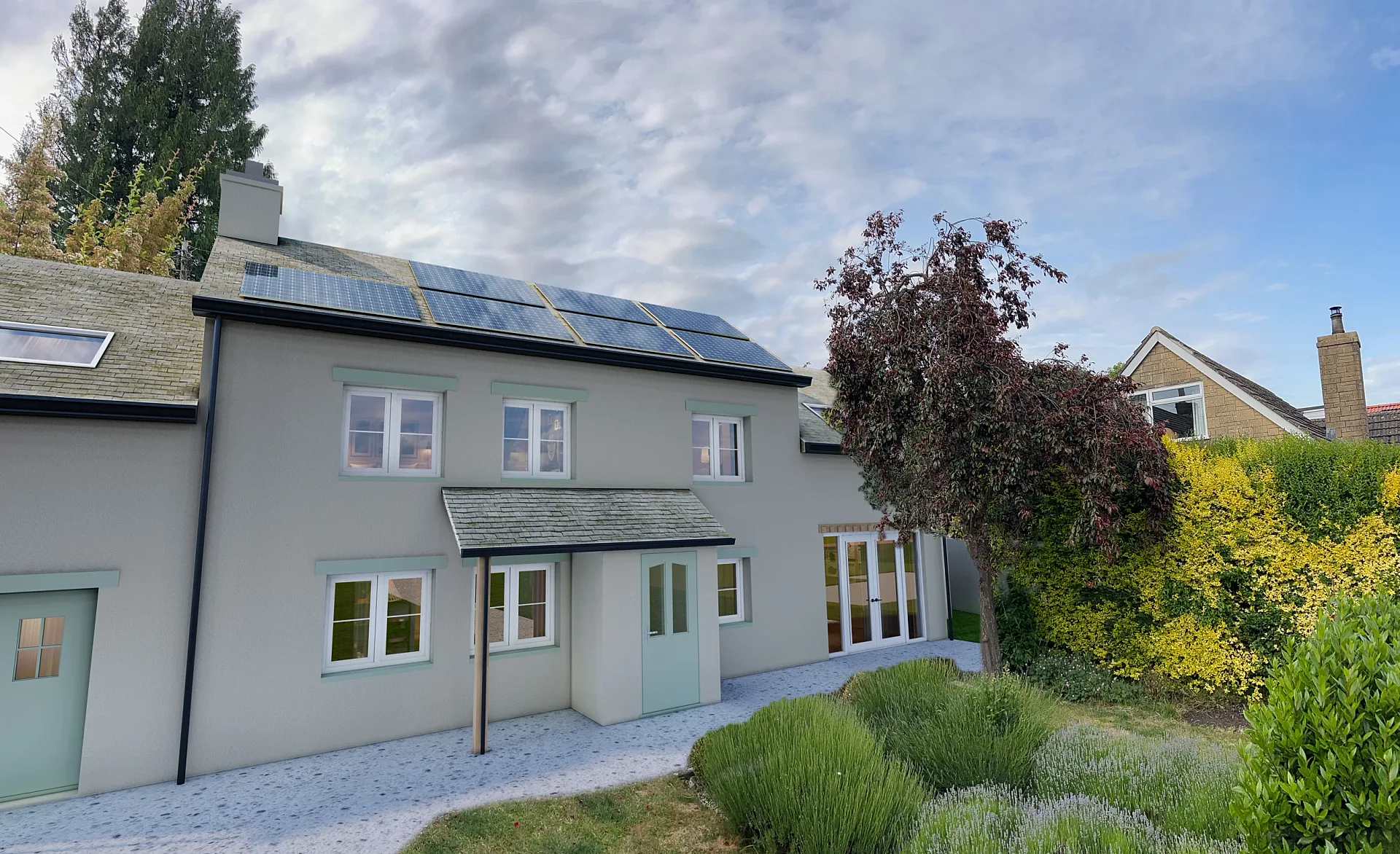 Two-Storey Extension Photomontages, Uley
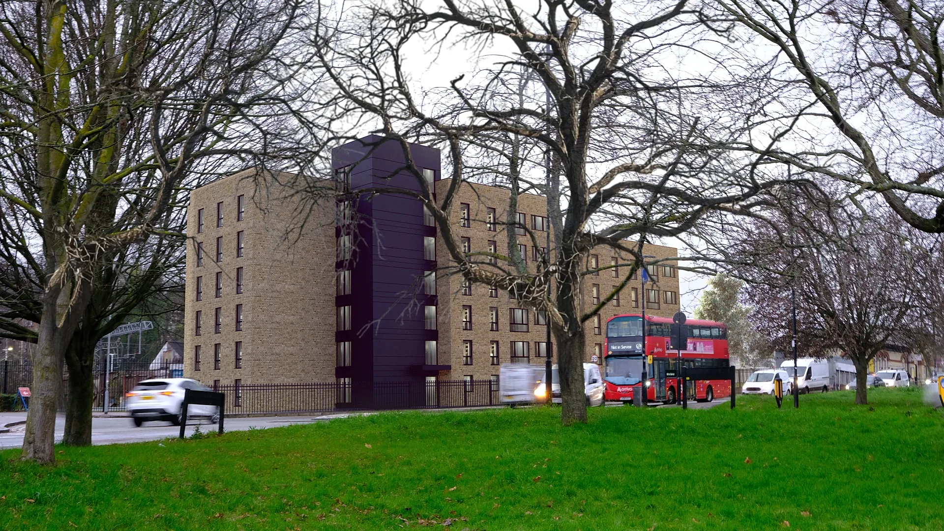
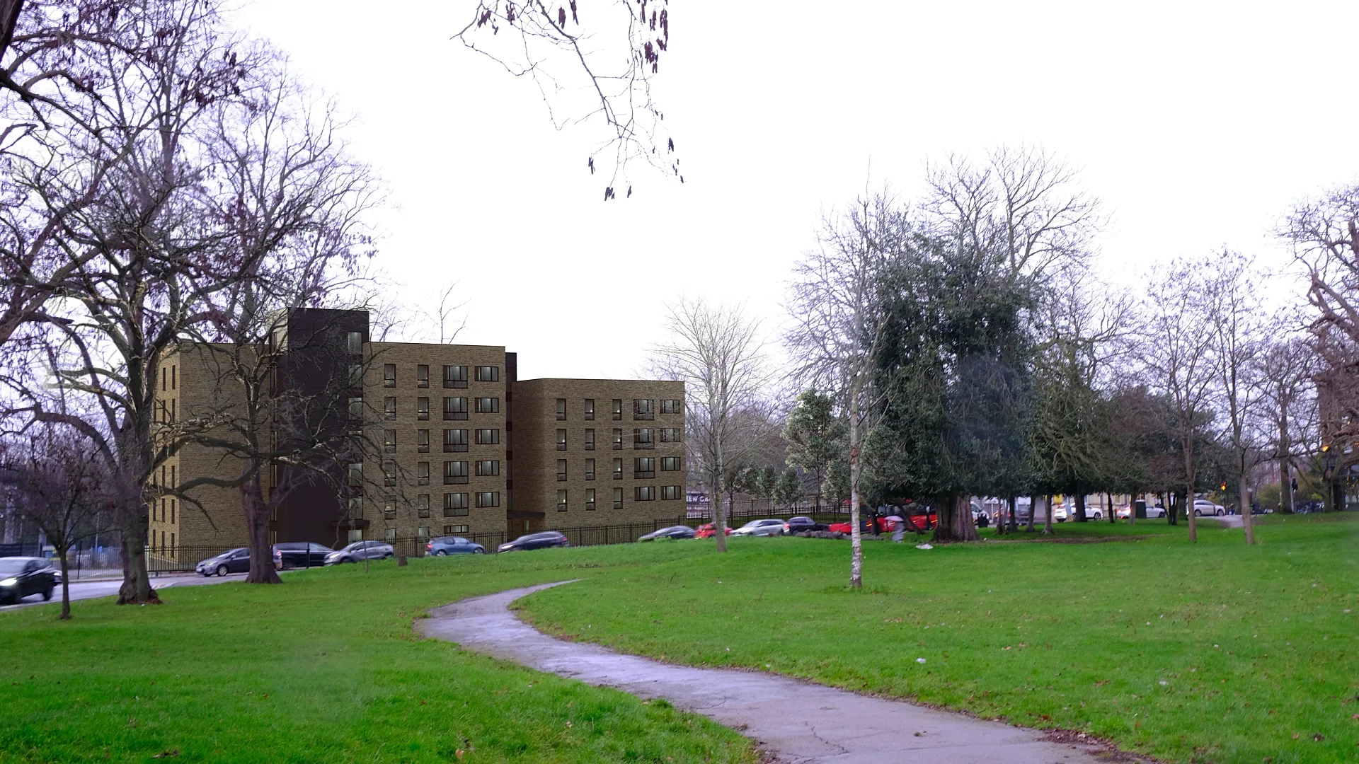 Pre-Application Photomontages for a Modular Building
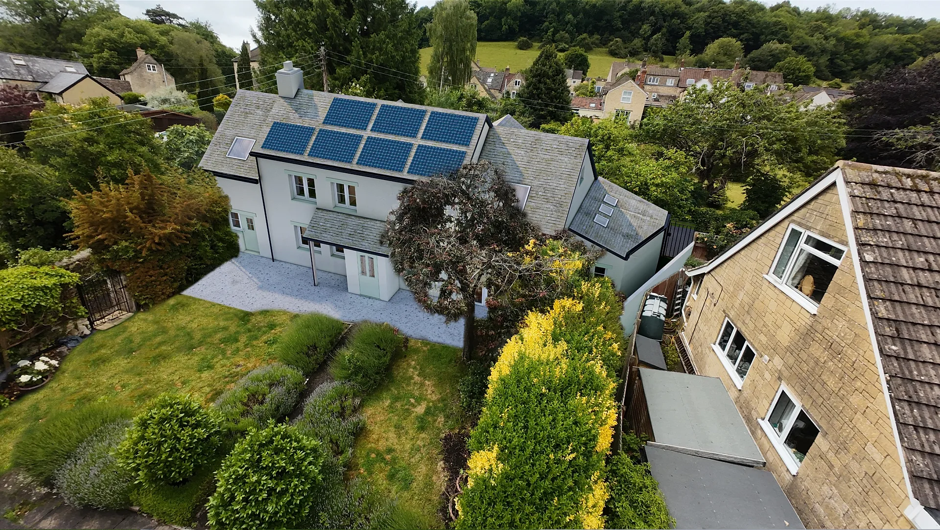 Two-Storey Extension Photomontages, Uley
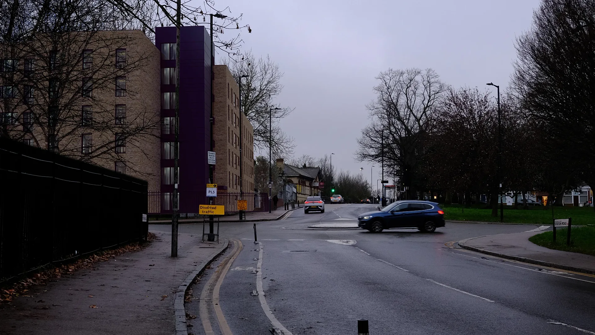 Pre-Application Photomontages for a Modular Building
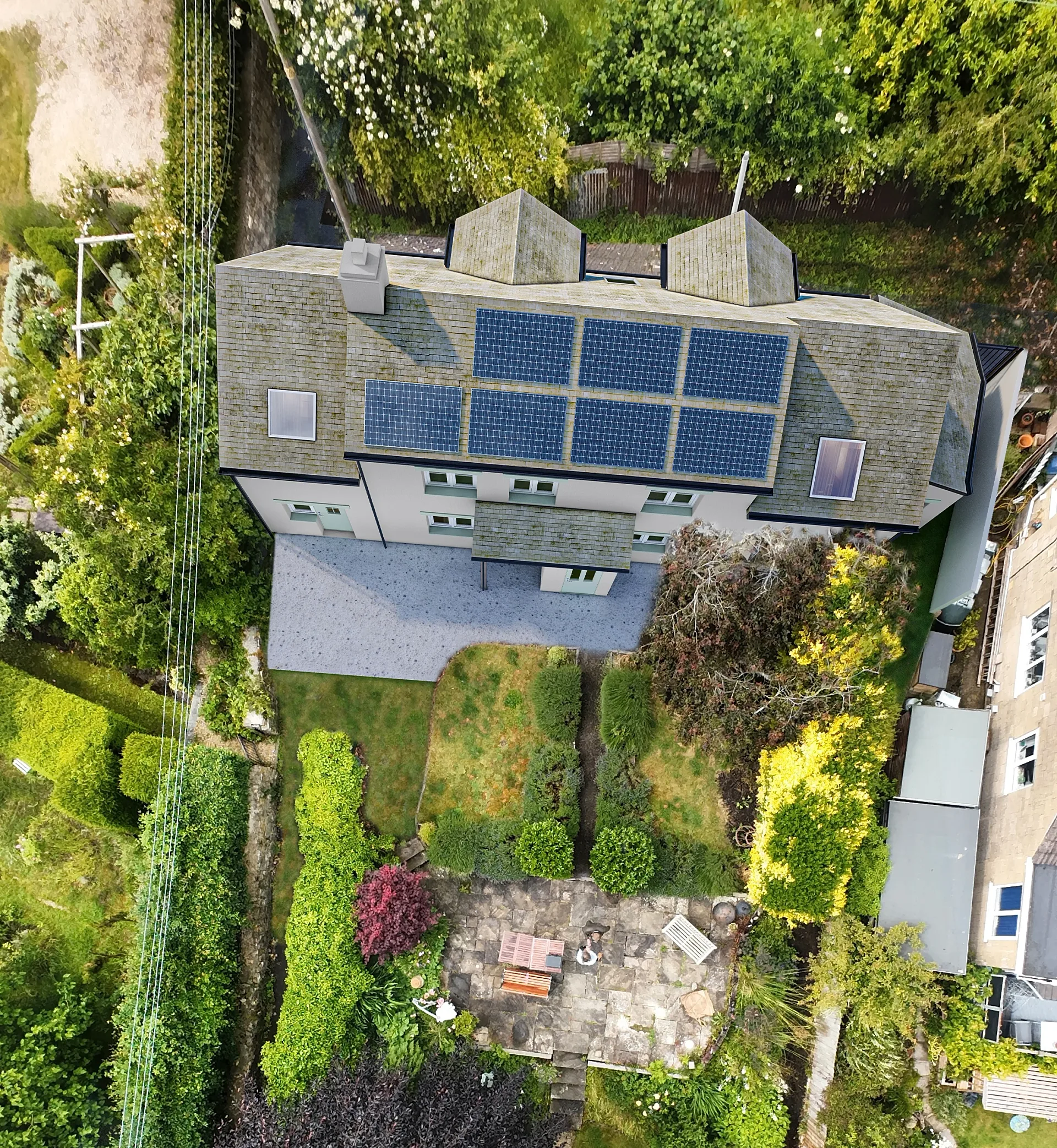 Two-Storey Extension Photomontages, Uley
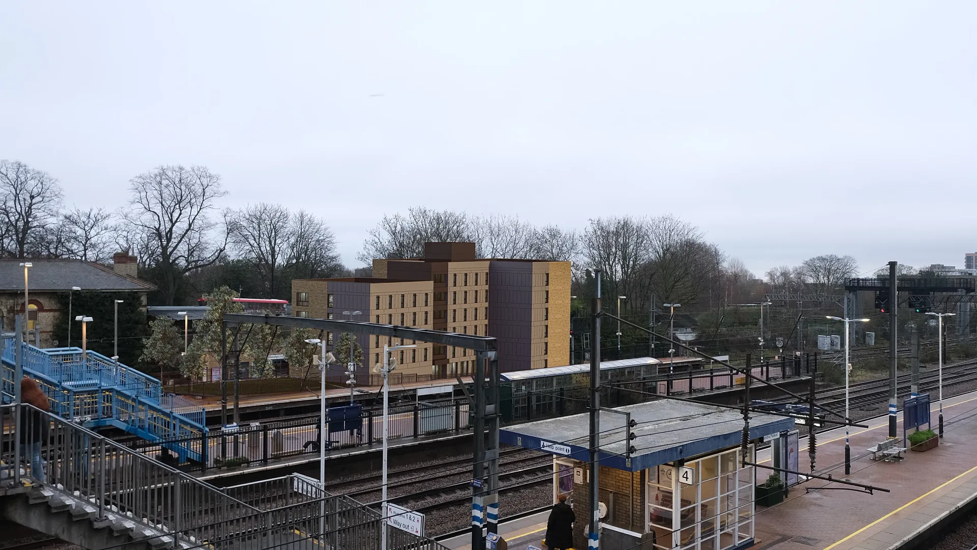 Pre-Application Photomontages for a Modular Building
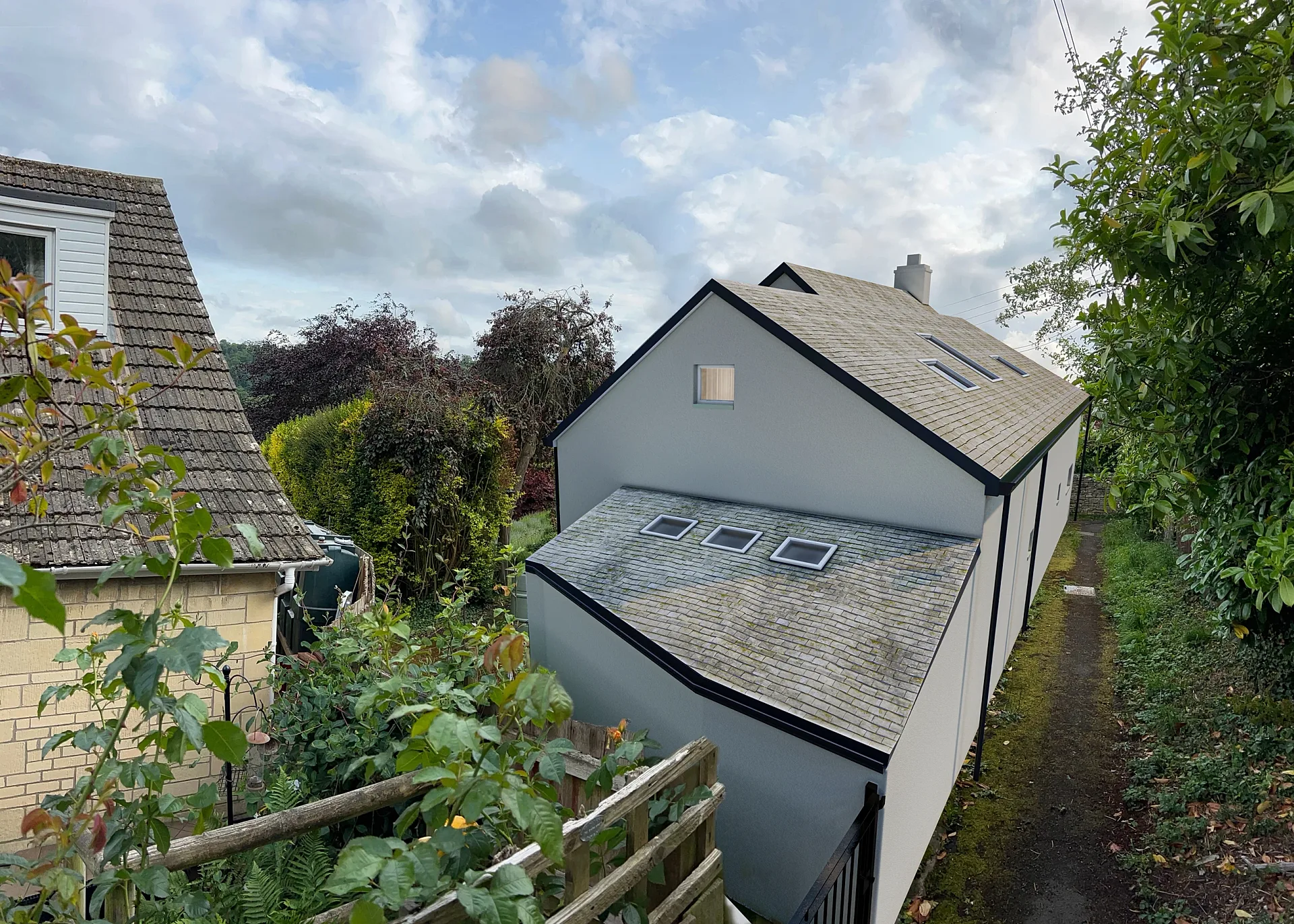 Two-Storey Extension Photomontages, Uley
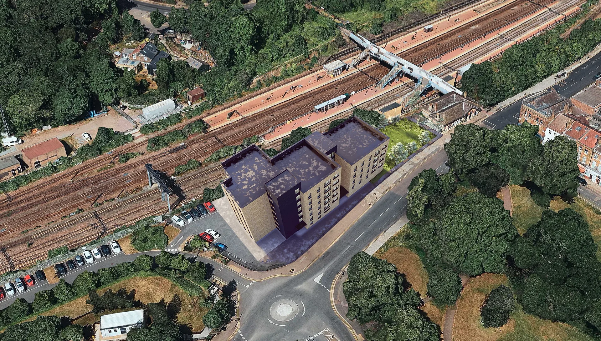 Pre-Application Photomontages for a Modular Building
What verified views and AVRs mean in planning
Neither verified view nor accurate visual representation (AVR) is a term defined in planning law, so it helps to tie them to the guidance that planning professionals actually work from. The Landscape Institute's Technical Guidance Note 06/19, Visual Representation of Development Proposals, was published in September 2019. It remains the current note while the Institute reviews it, and it sorts visualisations into four types according to how rigorously the image is tied to the real world.
When consultants and officers ask for verified views or AVRs, they normally mean Type 4: a photomontage whose camera locations and reference points have been fixed by survey, so the scale and position of the proposal can be checked by anyone who repeats the work. Type 3 uses the same compositing technique but aligns the model to the photograph itself rather than to surveyed coordinates. London adds a separate layer. The London View Management Framework of 2012 has its own AVR classification, numbered 0 to 3, for the views it manages; those numbers belong to the framework, not to the Landscape Institute, and the two systems should never be mixed up on a sheet.
- Type 1: an annotated viewpoint photograph.
- Type 2: a 3D wireline or model view.
- Type 3: a photomontage or photowire.
- Type 4: a photomontage or photowire that is survey and scale verifiable.
What we produce: camera-matched photomontages
Our work sits at Type 3. We take your photograph of the existing view, build the proposal in 3D from the planning drawings, and recreate the camera that took your photograph inside the model. The camera is placed at the position you recorded, given the focal length you noted, and then adjusted until the modelled context lines up with what is in the frame: building corners, kerb edges, ridge lines, window heads, lamp columns and boundary walls. When those features coincide, the proposal is rendered from the same camera, lit to match the sun and sky in your photograph, and composited into it.
The honest description of that result is a photomontage that is accurate to the photograph and to the recorded alignment. It is not survey-verified, and we never present it as if it were. For a large share of applications, including most householder schemes, extensions, infill houses and small residential developments, that is exactly the proportionate level of evidence. Officers see a realistic, traceable image, and the methodology note tells them precisely how it was made.
Where an authority or a consultee asks for survey-verifiable Type 4 views, the survey is commissioned by you or your planning consultant from a surveying firm of your choosing. If you supply the camera positions and control points fixed by that survey, we build the montage to that data instead of to visual alignment, and the methodology note records the survey as the source. What we will not do is call an unsurveyed image verified.
How to photograph the site for us
The quality of a photomontage is set on the day the photographs are taken, so a few minutes of care at each viewpoint pays off later. You do not need specialist equipment; a good camera or a recent phone held level will do, provided the details below are noted. If the officers have already agreed viewpoints at pre-application stage, photograph those exactly; if not, take several candidates for each view and we will help you choose.
Fixed reference features are what make an accurate match possible. A frame that contains only hedges, trees and sky gives us nothing reliable to align to, while a frame that includes a neighbouring gable, a kerb line or a telegraph pole lets the model lock into place. Aim for the widest frame that still shows the site clearly, because the extra context usually contains those features.
- Hold the camera at normal standing eye height, roughly 1.5 to 1.7 metres, not raised overhead or crouched.
- Keep the horizon straight and the camera level, without tilting up to fit a tall building in.
- Use the widest frame that still includes fixed reference features such as corners, kerbs, walls and poles.
- Note where you stood: a pin on a map, a marked-up site plan or a photograph back towards the spot.
- Note the lens or zoom setting and avoid digital zoom; send the original files, because their metadata often records it.
- Note the date and time, or keep the camera clock correct so the metadata records it for you.
- Take several candidates for each view, a step or two apart, in steady light.
The method we document with every montage
A convincing image is only part of the job. The other part is being able to show how it was made, so that a planning officer, a consultee or an objector can follow each step without taking anything on trust. Every study we deliver includes a short methodology note written for a planning audience. If a view is questioned months later at committee or appeal, the note answers the question.
The note is deliberately plain about where each piece of information came from. Camera positions and lens details are recorded as supplied by you, not presented as our measurements, and the alignment section explains which visible features the model was matched to. A reader can therefore judge the image for what it is: accurate to that photograph and that alignment.
- Which photograph was used for each viewpoint, with the original file name.
- The camera position as supplied by the client, shown on a viewpoint plan.
- The lens or zoom setting and the resulting horizontal field of view.
- The date and time of the photograph, so the lighting match can be checked.
- How the model was aligned, naming the features in the frame it was matched to.
- The drawings and model revision used, so the image traces back to a design.
- Any retouching applied, described in plain words, and the visualisation type stated.
When a local planning authority asks for photomontages
Many householder applications and minor schemes need nothing beyond clear drawings and perhaps an illustrative street view. Photomontages become useful where the visual effect of the proposal is itself a planning question. Common triggers are a site inside a conservation area, which the local planning authority designates; a proposal that affects the setting of a listed building, where the relationship between old and new is often how the impact is judged; and, in the capital, a scheme within a view protected by the London View Management Framework.
Requirements are set locally. Each authority publishes a validation checklist, usually called the local list, and pre-application advice is the right moment to agree which viewpoints officers want and which visualisation type they expect. Ask specifically whether camera-matched Type 3 montages are acceptable or whether surveyed Type 4 views are required, because the answer decides whether you need to commission a survey. Statutory determination periods are eight weeks for most applications and 13 weeks for major development, so it pays to settle this early.
Honest limits of a photograph-based montage
A montage built from an unsurveyed photograph is as good as the photograph and the alignment, and no better. If the recorded standing position is a few metres out, or the frame contains few fixed features, the alignment carries more judgement and the result carries more tolerance. We tell you when a view is weak for that reason and suggest a better frame rather than producing an image that looks precise but is not.
Some things a photograph cannot show either. Seasonal screening changes through the year, so a summer photograph will flatter a scheme behind deciduous trees; if winter conditions matter, the winter photograph has to be taken in winter. Proposed planting is shown at the size it will be when planted unless the brief asks for a stated future year, and the assumption is printed on the sheet. Existing buildings and street furniture stay in the frame; nothing is edited out to flatter the proposal.
Photomontage versus marketing CGI
A marketing image is composed to persuade. The camera goes wherever the angle is best, the lens is chosen for drama, the sky is picked for mood and the planting is often shown mature. That is right for a brochure, and we produce plenty of exterior CGIs for exactly that purpose.
A planning photomontage is composed to inform. The camera sits at the viewpoint you photographed, at eye height, with its lens declared; the sky and light are those in your photograph; and the proposal is shown honestly within its context. Both kinds of image can come from the same model, but they follow different rules and should not be swapped. Our guide to CGIs for planning applications explains where each fits in a submission.
Outputs for each viewpoint
Each viewpoint is normally presented as a short sequence, so the reader can compare the existing view, the outline of what is proposed and the finished montage side by side. The wireline is especially useful to officers because it shows the full extent of the building even where trees or existing buildings would hide part of it.
Sheets carry the viewpoint number, the date and time of the photograph, the lens and the visualisation type, so a single sheet makes sense on its own. Files are supplied for the application documents and as 4K images for showing on a screen at committee or design review. Where neighbouring consented schemes matter, we can model them from their published planning drawings and show them in a separate cumulative version, clearly distinguished from your proposal.
- Your photograph of the existing view, as the baseline.
- A wireline showing the outline of the proposal, with hidden parts marked.
- The rendered photomontage, lit to match the photograph.
- Optional cumulative views where other consented schemes are nearby.
Committee, design review and appeals
Where an application goes to a planning committee rather than being decided under delegated powers, photomontages are often the images councillors remember. We prepare screen versions with the same captions as the submitted sheets, so nothing shown on the night differs from what was formally submitted.
If an application is refused or not decided in time, the visual material may be examined at an appeal to the Planning Inspectorate. That is where a frank methodology note earns its keep: an image that states its source photograph, its camera data and its type is far harder to undermine than one that claims more than it can prove. In England decisions are made against the local plan and the National Planning Policy Framework (NPPF), while Wales follows Planning Policy Wales; the method we document is the same in both.
If the design changes through amended plans, the aligned camera is kept, the proposal is updated and the affected views are re-rendered onto the same photographs. The methodology note is reissued with a revision line, so everyone can see which views changed.
Scoping and pricing a photomontage study
Photomontage and verified view work is quoted per project, with the method documented. The quote lists the viewpoints, the visualisation type for each, how much surrounding context has to be modelled and which outputs are included, and it arrives within one business day of receiving the drawings and your photographs or proposed viewpoints. If the planning team is still deciding on viewpoints, we can quote on a provisional number and confirm once they are agreed.
Once the photographs are in hand, modelling and rendering follow the same rhythm as the rest of our work: a draft render with materials and lighting close to final, up to 4 revision rounds and finals at 4K, typically within 5–7 business days, assuming mark-ups come back within a day of each draft. Projects in the capital often pair a photomontage study with marketing images, and our page on 3D rendering in London covers that pattern. Looking for prices on the rest of the work? See our guide to 3D rendering cost in the UK.
Proof
Verified Views projects from the portfolio
How it works
How we produce verified views
- 01
Send your drawings
Plans, elevations and sections in PDF, DWG, SketchUp, Revit or ArchiCAD — or a marked-up sketch. Add material schedules, finishes and any reference photos you like.
- 02
Fixed quote in one business day
You get a per-image price in pounds, the delivery date and what is included. No hourly billing and no surprises at invoice time.
- 03
Draft render for your feedback
A draft render with materials and lighting close to final, sent for your feedback before we produce the finals — so your mark-ups are about real images, not diagrams.
- 04
Revisions from your mark-ups
You mark up the draft and we work through the changes. Up to 4 revision rounds are included.
- 05
Final delivery
Finals at 4K (TIFF/JPEG/PNG) sized for print and web, typically in 5–7 business days from brief, assuming mark-ups come back within a day of each draft. Rush delivery available in 48–72 hours (rush surcharge applies).
Questions
Verified Views: frequently asked questions
Both place the proposal into a real photograph. A Type 3 photomontage aligns the model to the photograph using the camera details recorded when it was taken and the features visible in the frame. A Type 4 verified view ties the camera and reference points to a survey, so the position and scale can be checked independently. Landscape Institute TGN 06/19 defines both.
No. We do not survey, and we do not send survey or drone crews to site. Every montage is built from your own site photographs, with the camera position, lens and time as you supplied them, and matched to features visible in the frame. The methodology note states this plainly and labels the work as a Type 3 photomontage.
Then the camera positions and control points need to be surveyed, and that survey is yours or your planning consultant's to commission. Send us the camera data from that survey with the photographs taken at those positions, and we will build the montages to that data and record the survey as the source in the methodology note.
Stand at normal eye height, keep the camera level and the horizon straight, and use the widest frame that still includes fixed features such as building corners, kerbs and poles. Note where you stood, the lens or zoom setting and the time, send the original files, and take several candidates for each view.
Photomontages and verified views are quoted per project, with the method documented. The price depends on the number of viewpoints, how much surrounding context has to be modelled and the outputs required. The quote itemises each element and arrives within one business day of receiving the drawings and your photographs.
Not always. Check the local validation list and raise it at pre-application advice, asking whether camera-matched photomontages are acceptable. They are most often requested in conservation areas, where a proposal affects the setting of a listed building, or for views managed under the London View Management Framework. A Design and Access Statement does not require them, though visuals often support one.
Often, yes. If the images are sharp, taken at eye height and include fixed reference features, and you can say roughly where you stood and when, they can support a camera-matched photomontage. If key details are missing, we will tell you which views are weak and what to retake.
We prepare camera-matched photomontages for London schemes and label them by the system that applies. Views managed under the London View Management Framework use the framework's own AVR classification, Types 0 to 3, which is separate from the Landscape Institute's types. Where a surveyed AVR is required, we build to the camera data your own survey supplies.
Where we work
Verified Views across the United Kingdom
The same published prices apply wherever the site is. Every project runs from your drawings by email, phone and video.
Verified Views is one part of our architectural visualisation work, and we produce it for 3D rendering in London projects as readily as anywhere else in the UK.
Related services
Often ordered with this service
3D Exterior Rendering
3D exterior rendering for UK developers and architects: street-level, aerial and masterplan CGIs from £295.
from £295
Property CGI
Property CGIs for UK developers and build-to-rent: exterior, interior and aerial CGIs for brochures, portals and hoardings.
from £225
Architectural Animation
Architectural animation, walkthroughs and CGI flythroughs for UK developments, from £45 per second (30-second minimum).
from £45
Get a fixed quote within one business day
Send us your plans, elevations or even a sketch. Exterior renders from £295, interiors from £225, delivered in 5–7 business days.