Planning & photomontage · case study
Two-Storey Extension Photomontages, Uley
Photomontages of a proposed two-storey extension placed into the homeowner's own photographs, produced to support a householder planning application in Uley.
- Location
- Uley, South West
- Renders like these, from
- Quoted per project
- Turnaround
- 5–7 business days, assuming mark-ups come back within a day of each draft
- Revisions
- Up to 4 rounds included
- You send
- Site photographs, the model or drawings, and the survey data if you have it
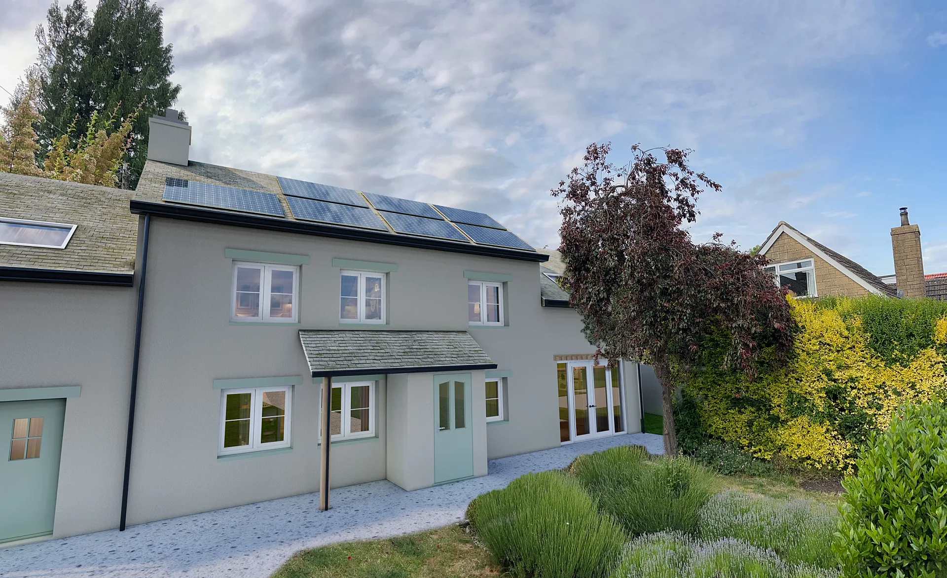
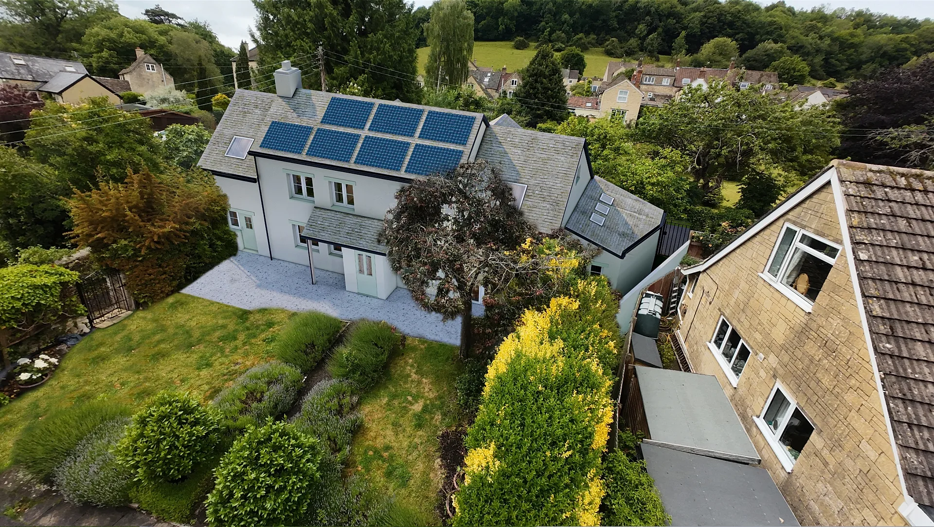
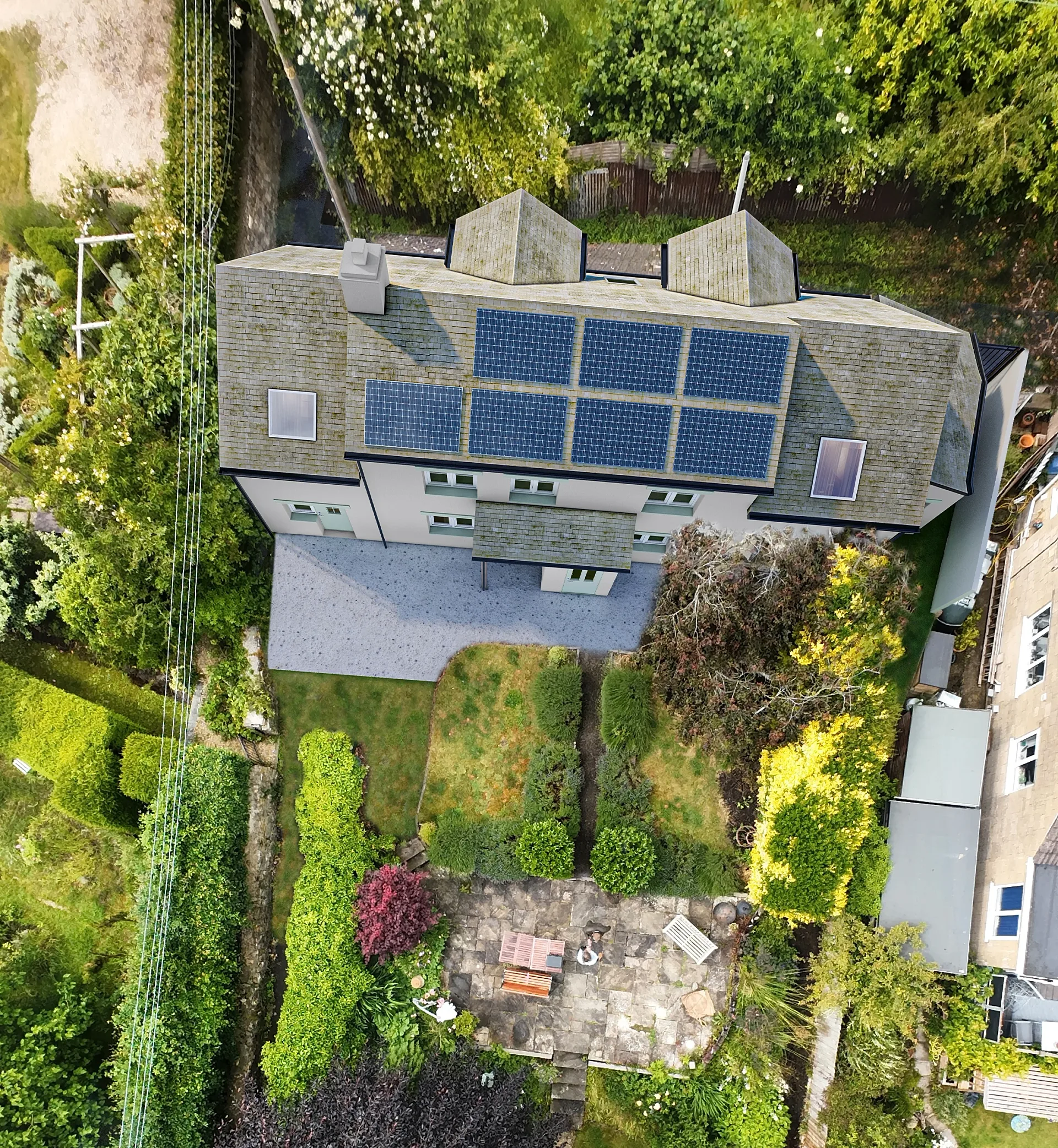
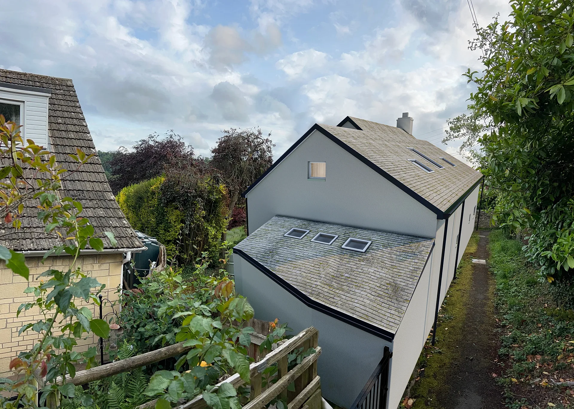
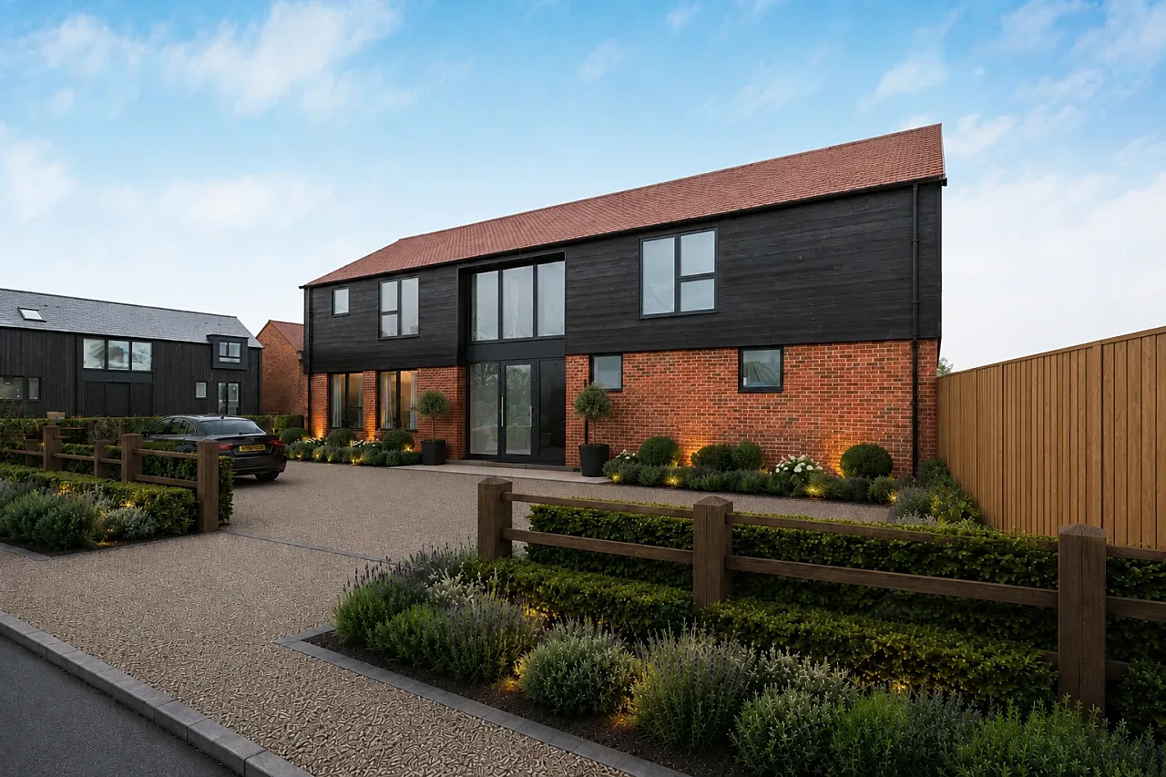
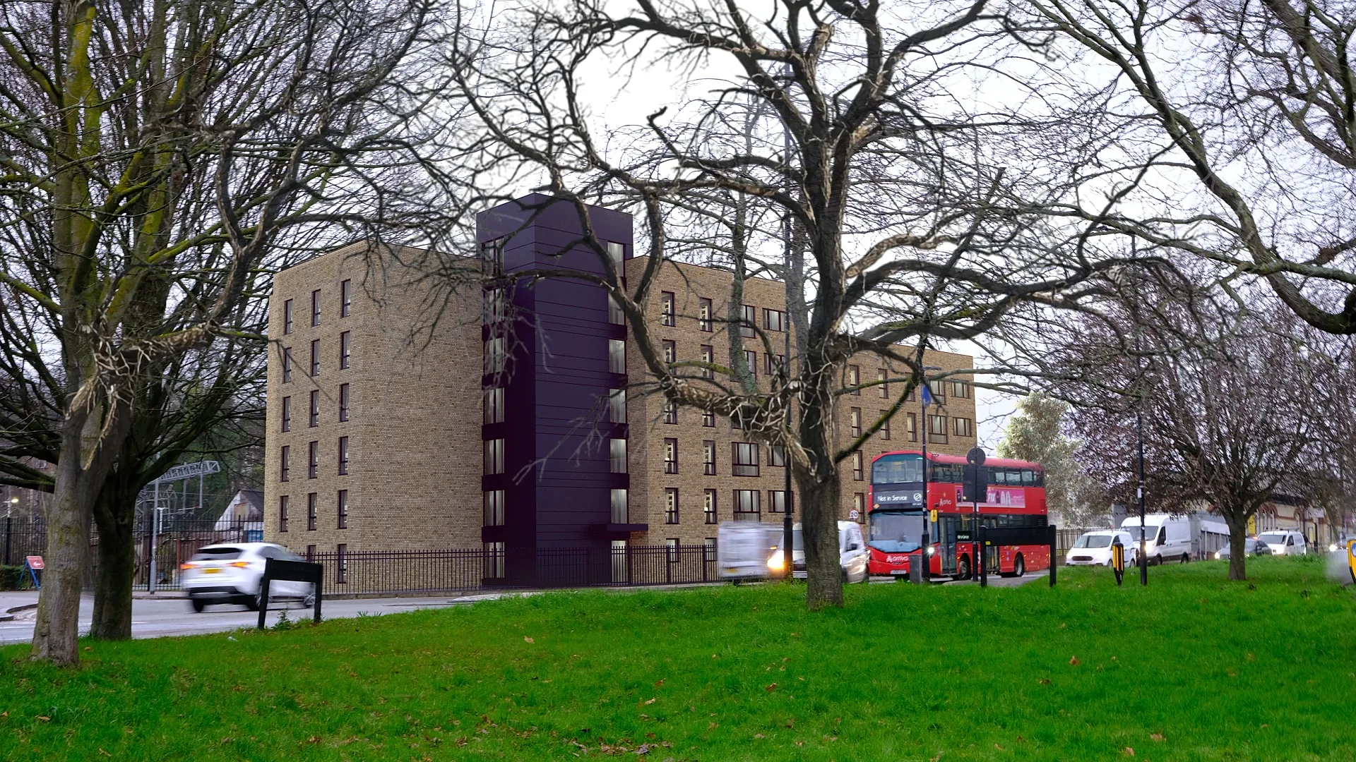
A selection from the delivered set.
The brief
The homeowner needed to show how the extension would sit in its real setting: beside the neighbouring house, among the trees, seen from the public footpath and from the garden. Four views were agreed, from the front, across the gap to the neighbour, from the footpath at the rear and from a drone over the back of the house, and a fifth was added later.
Our approach
The proposal was modelled from the architect's elevations, floor plans, block plan and DWG files, then set into the client's photographs and drone shots in an off-white render to match the existing house. Revisions straightened a corner on the single-storey side element and corrected a window, and the client's planning consultant then asked for further changes. The fifth view repeats the footpath position with the revised rear roof, its dormers removed and the eaves raised.
The result
The final upload was on 8 July 2025 and the client signed the set off on 14 July. Four of the five views are shown here.
Showing the extension where it will stand
A planning officer or neighbour reading an elevation sees lines; a photomontage shows them the house. These images were produced to support a householder planning application in Uley. The homeowner needed to show how the extension would sit in its real setting: beside the neighbouring house, among the trees, seen from the public footpath and from the garden. Four views were agreed, from the front, across the gap to the neighbour, from the footpath at the rear and from a drone over the back of the house, and a fifth was added later. Four of the five are shown here.
Camera-matched to real photographs
Every view starts from a photograph. The proposal is set into the client's own pictures and drone shots in an off-white render chosen to match the existing house, so the extension inherits each photograph's lens, height and light. Mature planting stays exactly as photographed, with foreground branches kept in front of the new work where they truly stand. The drone views look down the garden and across the rear roof to the neighbouring property and the narrow gap between them, and the footpath view shows the gable end and the lower roof. Nothing is widened, trimmed or hidden.
Modelled from the architect's drawings
The proposal was modelled from the architect's elevations, floor plans, block plan and DWG files, then aligned to fixed points in each photograph such as rooflines, windows and the footpath edge. Revisions straightened a corner on the single-storey side element and corrected a window, and the client's planning consultant then asked for further changes. The fifth view repeats the footpath position with the revised rear roof, its dormers removed and the eaves raised. The final upload was on 8 July 2025 and the client signed the set off on 14 July.
Briefing photomontages for a planning application
Planning images are scrutinised, so accuracy matters more than polish. Send original full-resolution photographs, say where each was taken and at what time of day, and tell us what your local planning authority expects. If it asks for verified views or Accurate Visual Representations in line with Landscape Institute Technical Guidance Note 06/19, that usually means a surveyed method: the survey is yours to commission and we build the montage to its camera data, quoted per project with the method documented, and a photomontage from unsurveyed photographs is not a substitute. If the design may change during consultation, expect to add a view, as happened here. Up to 4 revision rounds are included.
Questions
Planning & photomontage: questions clients ask
A photomontage is camera-matched to a photograph and shows the proposal in context. Verified views go further: the camera and surrounding points are surveyed so the accuracy can be shown. Some planning authorities require them, in which case you commission the survey and we build to its data. Both are quoted per project, with the method documented, so tell us what your authority asks for.
Original, full-resolution photographs from where you want each view, including the public footpath if it matters. Note the time of day and avoid zoom or heavy filters. Drone shots also work if height and position can be estimated. We can advise on extra photos before you shoot.
A revised roof or eaves line can be rendered into the same photographs, or a new view added, as happened with the rear roof here. Up to 4 revision rounds are included, and a typical set takes 5 to 7 business days, assuming mark-ups come back within a day of each draft.
Get a fixed quote within one business day
Send us your plans, elevations or even a sketch. Exterior renders from £295, interiors from £225, delivered in 5–7 business days.